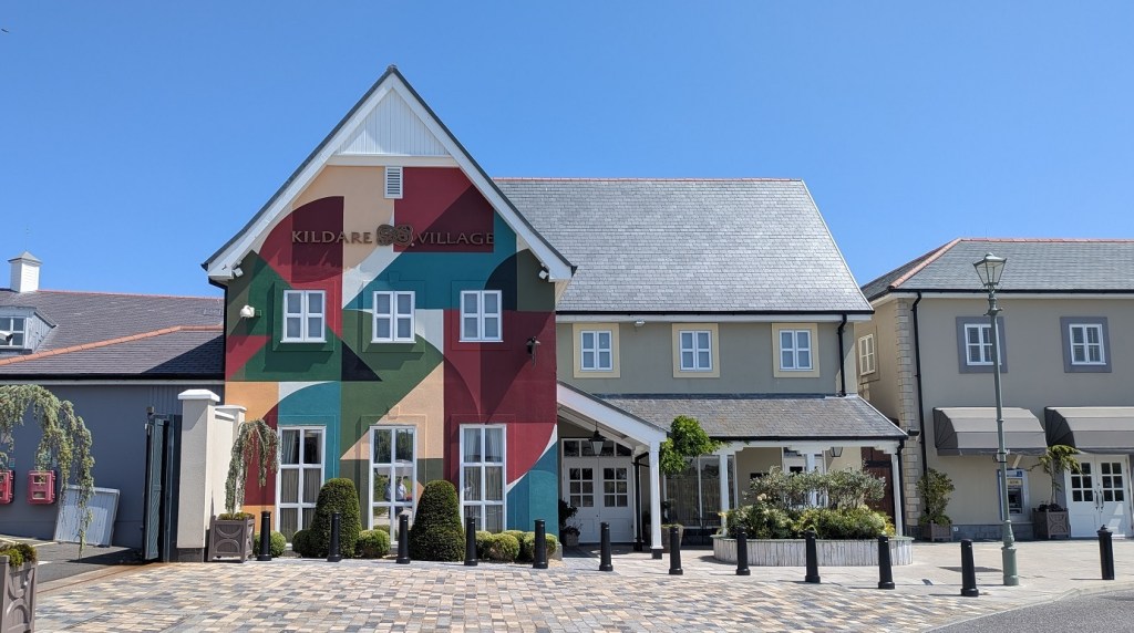
Kildare Village attracts thousands of visitors each year in search of designer brands and discounted luxury goods. Few of those visitors are likely to consider the much older history of the land beneath their feet. Yet long before the boutiques, cafés and the car park, this area formed part of a landscape that was shaped by generations of people whose traces survive in the archaeological record.
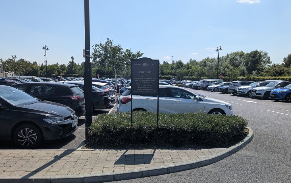
During this summer, on probably one of the hottest days of the year, I took a trip to Kildare Village with my mother. While she scooted off for some shoe shopping, I went exploring and thought why not point out where these archaeological features are so the next time others come to shop, they can also take a moment to think about the land beneath their feet and what stories it holds.
Building Around the Past
In Ireland, archaeology must be considered before any construction begins because archaeological heritage is protected by law1. In 2005, prior to the building of Kildare Village and given the close proximity to the above ground visible remains of the church and graveyard, and the known historical importance of the Kildare townland, archaeological investigation and assessment were undertaken2. The development site comprised three fields and two fields were excavated. The excavation did not cover the principal friary buildings in the east. All features identified were recorded and preserved with the retail units built around them.
According to the National Monument Service (NMS), there are six archaeological monuments within Kildare Village, from west to east: fulacht fia, well, burial, kiln, religious house, and graveyard.
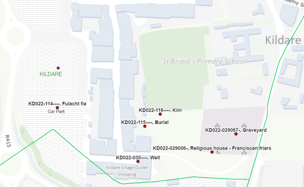
Bronze Age Activity at Kildare Village
A fulacht fia (KD022-114) was discovered in Field 2. A fulacht fia, usually consists of a horseshoe-shaped mound of fire-cracked (burnt) stones, and is often associated with a trough or pit. Their exact function is debated, but interpretations include cooking, heating water, and other activities involving heated stones.
Measuring approximately 1.8 metres by 1.25 metres wide and 0.48 metres deep, the pit had been filled with three layers of burnt sandstone mixed within a charcoal-rich deposit. These remains provide evidence of prehistoric activity in the landscape, possibly linked to cooking or the heating of stones for processing food or other materials.
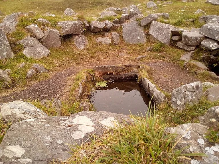
To get an idea what they looked like I have included a photo of the Drombeg fulacht fia below, and you can see Wild Atlantic Way’s short video of their recreation of Bronze Age cooking in one.
North of where the toilet facilities are now, a cremation burial (KD022-115) of a juvenile and an associated marker post, was discovered. The charcoal of the burial deposit was radiocarbon dated to 1310–1142 BC, the Middle to Late Bronze Age.4 During this time in Ireland, cremation was the dominant mortuary rite. The deceased were cremated on a pyre, and the resulting bone fragments were sometimes collected and buried in pits, urns or other funerary settings5.
A number of additional postholes were also excavated in the area and may also be of prehistoric date6. Postholes are the remains of wooden posts that once stood in the ground, their timber having since decayed. In isolation, they can be difficult to interpret, as they may represent anything from fence lines and animal enclosures to the supports of buildings or other timber structures. Their arrangement, spacing and relationship to other archaeological features help determine their original purpose and date. The original purpose of the posts in this area, and any possible relationship with the cremation burial, remain uncertain.
Iron Age Activity at Kildare Village
About 30 metres north east of where the cremation was found, an Iron Age kiln (KD022-116), preserved beneath the remains of an earthen platform, was uncovered. It was figure-of-eight in plan and measured 2.7 metres in length. A radiocarbon date of 196–4 BC was obtained.
Figure-of-eight kilns7 are characterised by two connected chambers and are commonly associated with grain drying in Ireland, but other uses have been proposed for similar structures such as malting grain8. Many examples date to the early medieval period, so given the dates acquired here this form of kiln is early in comparison.
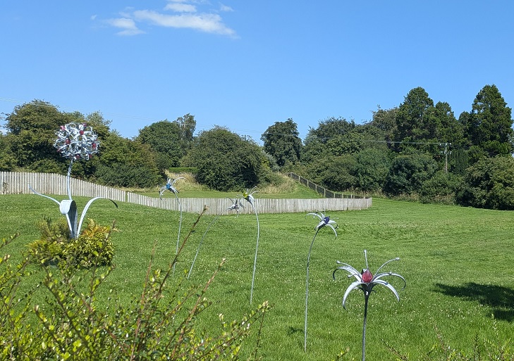
Medieval to Modern Period at Kildare Village
Immediately east of the shopping outlet and accessible by a wooden walkway, lies the remains of a Franciscan friary (KD022-029006; KD022-02906), probably founded between 1254 and 1260. It was closely associated with the FitzGerald family, the Earls of Kildare, who used its church as a burial place.
The Franciscan Order was founded by St Francis of Assisi in the early 13th century, receiving papal approval in 1209. A Franciscan friary was a religious establishment where friars lived communally, following the teachings of St Francis of Assisi, which emphasised poverty, humility, prayer, preaching and service to others. As a mendicant order, the Franciscans traditionally relied on alms and donations rather than personal wealth.
Youghal Franciscan Friary (South Abbey), County Cork, is traditionally regarded as the earliest Franciscan foundation in Ireland, dating to 1224, although its precise foundation date is uncertain. The earliest clear documentary reference to a Franciscan house in Ireland is a royal writ concerning the Dublin friary, dated 12339.
Friaries provided centres for worship, preaching and pastoral care, and their churches sometimes served as burial places for prominent local families. The burial of members of the FitzGerald family, Earls of Kildare, in the friary church reflects its association with the local aristocracy as well as its religious function.
The 2005 excavation did not cover the principal friary buildings, concentrating instead on the earthen platform and garden areas. The platform had previously been interpreted as a modern construction. Excavation along its southern and western edges showed that it was built upon a natural hill, and modified into an enclosure by three parallel ditches. Material from the ditches was used to form banks towards the centre.
Finds from the ditches included animal bone, 13th century floor tiles, 12th–13th century Dublin-type pottery and a medieval horse-harness pendant. Because the enclosure interior was not excavated, its precise purpose could not be established. Possible interpretations included a hospital, an animal enclosure or an early settlement area used by the friars.
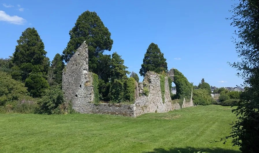
The surviving structure is mainly 13th century, with 15th century window insertions and possibly 14th-century buttresses on the north wall of the chancel. Two sections of the original south wall survive, rebuilt in the middle and now forming part of the graveyard’s southern boundary.
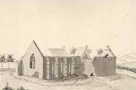
By 1539, the friary comprised a church, belfry, dormitory, hall, kitchen, chambers, cemetery and gardens. Following its surrender during the Dissolution of the Monasteries, much of the complex had been destroyed by fire.
The O’Conors, a Gaelic Irish family from Offaly, traditionally opposed to Anglo-Norman power in the region, raided and burned the friary in May 1539, shortly after its surrender. The friary was re-established in 1621.
The garden area contained drains and agricultural features that managed the friary’s water supply. The drainage system included central reservoirs designed to remove excess water during wet weather and retain water for irrigation during dry spells. By the late 13th or early 14th century, a ditch formally separated the garden from the lawn.
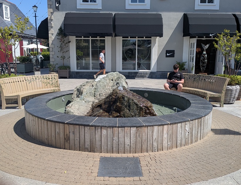
Excavation showed that Friar’s Well (KD022-114), which is in front of the Nike shop, was not a conventional well but a pool at the end of a naturally eroded stream bed. A low limestone wall, capped with flagstones, defined the western bank and helped retain water. The feature was often dry, even during winter. Although no datable evidence was recovered, the report suggests that the wall may have been built during the friary’s expansion in 1350.
It is possible that the stream bed may have held water more consistently during the Bronze Age than it did in later centuries, when it may have pooled following heavy rainfall. Although its precise character at the time is unknown, the watercourse may have provided a convenient water source for the fulacht fia.
The curving townland boundary also followed a former stream bed. Two parallel ditches formed the boundary, with the excavated material creating a central bank. Finds indicated a 17th-century construction date.
An 18th century sub-circular structure was found beside the western boundary of Field 1 (car park area). It measured 4.2 metre by 3.1 metre internally, or 5 metre by 3.9 metre externally, and survived to 1.85 metre below the modern ground surface. Its lower section was built of limestone blocks and had joist sockets, suggesting a basement; the upper section was constructed of handmade brick. Slate fragments suggest that it had a roof. Its function remains uncertain, although the basement may have served as a cold store.11
Another Reason to Visit Kildare Village
Kildare Village is a place where several thousand years of human activity lie beneath a landscape now associated with shopping and leisure. From Bronze Age burial and the fulacht fia to the Iron Age kiln, medieval friary and its carefully managed water systems, the archaeological remains offer glimpses of how people lived, worked and shaped this place long before its present use.
Importantly, the archaeological features identified during the 2005 investigations were recorded and preserved, with the retail development built around them. The past has not simply disappeared beneath the modern landscape – elements of it remain, sometimes visible and sometimes hidden in the ground.
The next time you visit Kildare Village, perhaps take a moment to look beyond the shopfronts and consider the history beneath your feet – a landscape with stories that reach far beyond the modern shopping outlets.
- Planning and Development Act 2000; National Monuments Acts 1930–2014; Historic and Archaeological Heritage and Miscellaneous Provisions Act 2023 ↩︎
- 04E0233 and 04E0233 Ext. ↩︎
- A.-K. D. (2017) Fulacht fia at Drombeg Stone Circle. Wikimedia Commons. Available here ↩︎
- Late Bronze Age (1200 BC – 500 BC); Middle Bronze Age (1500 BC – 1200 BC) ↩︎
- To get an idea of what was involved in this kind of burial rite, in 2020, the Hungarian National Museum and Eötvös Loránd University reconstructed Late Bronze Age cremation using two experimental funeral pyres ↩︎
- Dennehy E. 2008, No. 757, 184-5 ↩︎
- Moloney, C., Long, P. and Ó Maoldúin, R. (2025) Landscapes with Lineage: Archaeological Discoveries along the M9 Motorway in South Kildare. Dublin: Transport Infrastructure Ireland, Illus. 4.16. Available at: https://www.tii.ie/media/hdxdbfkz/landscapeswithlineage_lowres_final.pdf ↩︎
- Lynn, C.J. (2006) ‘Some Iron Age figure-of-eight plan structures in Ireland: problems of interpretation with particular reference to the example from Navan, Co. Armagh’. Emania, 20, pp. 5–19 ↩︎
- A History of the Franciscan Order in Ireland ↩︎
- Austin, C. (1784) Grey Abbey [Drawing]. National Library of Ireland. Available at: https://commons.wikimedia.org/wiki/File:Grey_Abbey.jpg ↩︎
- Excavation details edited from: Dennehy, E. (2008) ‘Kildare/Grey Abbey, Kildare’, Excavations 2005, No. 757. Available at: https://excavations.ie/report/2005/Kildare/0013762/ ↩︎


Leave a Reply